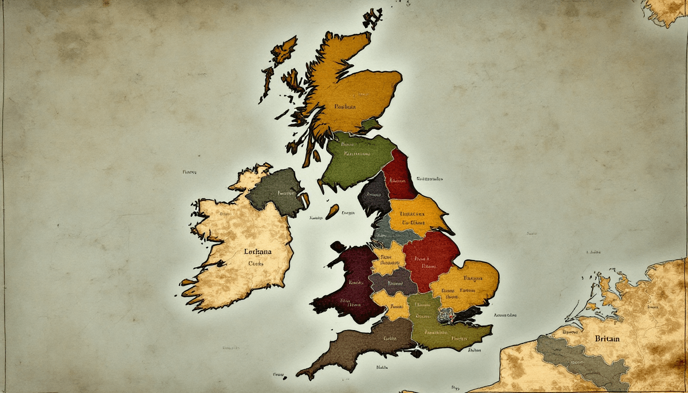
Restoring Clarity: The Case for the Historic Counties of Great Britain
Britain's historic counties, unchanged for centuries, are being confused with modern administrative areas created since 1888. The Campaign for Historic Counties calls for clear distinction between geographic and council areas to restore pride and clarity.

Britain’s counties are woven into the very fabric of our national identity. From the rolling downs of Norfolk and the maritime shire of Morgannwg, to the majestic mountains of Inverness-shire, the tapestry of our nation owes much to the enduring presence of our historic counties. Yet, in recent decades, this tapestry has been muddled and frayed - not by neglect, but by confusion sown inadvertently by local government reforms and the inconsistent use of county names.
This confusion threatens the integrity not only of our geographical heritage, but of our cultural story, our sense of place, and even our civic pride. Our Historic Counties are being forgotten - erasing centuries of identity, heritage and pride.
The Roots of Confusion: A Tale of Names and Boundaries
To a visitor or even a resident, the notion of a “county” in Great Britain might seem simple, if not self-evident. Yet, peel back just one layer and the certainty vanishes. You may be welcomed to “Merseyside,” only to discover that Merseyside as an administrative area existed for a mere 12 years, abolished in 1986. Or perhaps you live in “Cumbria,” a council area created in 1974 to provide services to the counties of Cumberland and Westmorland, with part of Lancashire and Yorkshire, which was abolished in 2023.
For centuries, the historic counties served as the primary building blocks of local identity. They provided the backdrop to our histories, the allegiance for our sporting teams, and the structure for everything from locations to census returns. Then, beginning in the late 19th and accelerating in the 20th century, Parliament enacted sweeping local government reforms. ‘County’ councils were created, abolished, enlarged, divided, and renamed. Sometimes new authorities were invented that Parliament called ‘counties’ but which were not counties at all, while *actual* counties were merged, split, or shunted aside for administrative purposes.
This fluid administrative landscape has left the public adrift in a sea of county names, many used interchangeably but with vastly different meanings. Today, local councils may call themselves by names that echo historic counties or, just as likely, by the names of administrative creations with no deep roots in local consciousness. The result: widespread confusion, a dilution of historic identities, and a disservice to both heritage and community.
Why Historic Counties Matter
Some may argue that this is a trivial issue, a quirk of history with little bearing on the present. But the importance of historic counties runs deeper than mere nostalgia. They represent a living link to the past, a framework for belonging, and an organic geography that has shaped local culture for centuries.
Historic counties precede the administrative inventions of the 19th and 20th centuries by many centuries, in fact more than a thousand years in some cases! Their boundaries are time-honoured, reflected in local traditions, dialects, and folklore. They define where we were born, where our ancestors lived, and where communities have flourished for generations.
When local authorities confuse or conflate these historic boundaries with their own, often short-lived administrative units, it severs a link with the past and clouds our understanding of who we are and where we come from. It also complicates the vital work of historians, genealogists, and archivists who rely on stable, well-defined county boundaries for their research.
Most importantly, the historic counties are the geography of our islands – the geography of the past, and the geography of today. They are not council areas or any other form of administration. They describe *where* places are, not who empties the bins.
In fact, while each historic county may have originally been set up for some public purpose or other, long before the beginning of the nineteenth century it was their geographical and cultural identities that were paramount.
The counties were always considered to be territorial divisions of the country, whose names and areas had been fixed for many centuries and were universally known and accepted.
As the notes to the 1831 Census state:
“From the Domesday Book of the Conqueror (AD 1086) it is known that County limits have since that time undergone no alteration; in fact they have been jealously maintained” – a confirmation that those who assert that county boundaries have ‘always changed’ are wrong.
The Current Landscape: An Alphabet Soup of Counties
The confusion is real, and its effects are visible everywhere. Take postal addresses: for decades, Royal Mail insisted that their own invention of ‘Postal Counties’ be used - not always matching historic ones or even administrative ones - leading to the absurdity of places in “Cleveland” (abolished 1996) or “Humberside” (abolished 1996) appearing on letters long after these councils ceased to exist. Sports fans may chant for Lancashire, while living in a place now being called “Greater Manchester.” In some cases, residents born and bred in Middlesex or Rutland find themselves told they live somewhere else entirely.
Even government websites and local authority communications add to the muddle. In one council’s literature, “Nottinghamshire” might refer to the historic county; in another, it means the administrative ‘county’; and elsewhere, it might reference a ceremonial ‘county’ (more properly called a ‘lieutenancy’) with yet another set of boundaries. For many, the result is a persistent uncertainty about where they live in terms of real identity and heritage.
How Did We Get Here?
The story begins with well-intentioned reforms: the Local Government Acts of 1888, 1889 and 1898 in England & Wales, Scotland and Ireland respectively, introduced elected county councils, carving up ancient counties into council areas for the first time. Subsequent acts, for example in 1965 and 1974, further redrew the administrative map, creating metropolitan and non-metropolitan ‘counties’, and in some instances, erasing historic counties from all practical use. These changes may have improved administrative efficiency, but they came at the cost of clarity and continuity.
Moreover, the practice of naming new administrative areas after historic counties, while drawing their boundaries differently, has only deepened the confusion. Even ceremonial ‘counties’, used for purposes such as lieutenancies or judicial administration, rarely correspond with the boundaries our ancestors would recognise.
When local councils use historic county names and their area bears little resemblance to those counties, they are not protecting our heritage – they are replacing it.
Remedying the Confusion: A Path Forward
What, then, can be done? The solution is not to abolish modern councils or to turn back the clock. Rather, it is to restore respect and clarity to the concept of the historic county, ensuring that it is recognised and celebrated alongside any administrative units.
The UK Government’s Office for National Statistics (ONS) now publishes an ‘Index of Place Names’ (IPN), which lists every city, town, village and locality alongside its historic county, lieutenancy and council area. In the IPN User Guide, the ONS further states that the historic counties “have existed largely unchanged since the Middle Ages” and so “are recommended as a stable, unchanging geography which covers the whole of Great Britain”. This is a huge step forward and one that we applaud. However, more needs to be done:
- Clear Distinction in Naming: Local councils and public bodies should be required to distinguish explicitly between historic counties and administrative areas. Where a council area does not align with a historic county, its communications should make this transparent, ideally using different names or qualifying terms (e.g., “Oxford City Region” rather than “Oxfordshire” – after all, despite being promoted as Oxfordshire, the current ‘Oxfordshire County Council’ area is not actually Oxfordshire at all!).
- Restoration in Signage and Official Use: Road signs, maps, and official documents should recognise and, where appropriate, display historic county names and boundaries. This could be achieved without causing confusion for service delivery - and would greatly aid in reviving local pride and identity.
- Education: Schools, local museums, and media outlets should be encouraged to highlight the rich heritage of our historic counties, fostering an understanding of the difference between administrative areas and geographical counties.
- Digital Platforms and Data: Government websites, postal databases, and mapping services should provide users with both historic county and council area information (as the IPN already does), making it easy to see where administration (councils) differs from geography (counties).
- Legislative Recognition: Parliament should pass legislation formally recognising the boundaries of the historic counties and realign the lieutenancies to match the historic counties, as was the case for 400+ years, ensuring that they are preserved as an official layer of the national geography, distinct from but complementary to local government units. The ONS has already set the precedent of promoting the historic counties and their precise definition in the ‘Historic Counties Standard’ published by the Historic Counties Trust.
The Benefits: Pride, Clarity, and Continuity
By restoring clarity between historic counties and local council areas, we do more than tidy up our maps: we restore pride in local identity, offer continuity to generations past and present, and provide the public with an honest, unchanging geography. England, Scotland, and Wales each boast a rich patchwork of counties that have weathered centuries of change. Their stories deserve to be told, understood, and preserved.
Moreover, this clarity would help newcomers and long-standing residents alike. For those tracing their family histories or seeking to understand local traditions, knowledge of the historic county can be transformative. For communities struggling with a sense of belonging, it can provide a bedrock of shared identity.
It would also end the need for local authorities to jealously covet the name of their council. ‘Lancashire County Council’ and ‘Oxfordshire County Council’ are two such examples of authorities who seem to believe that their council boundaries are Lancashire and Oxfordshire respectively, when they are no such thing. The former is barely half of Lancashire plus part of Yorkshire, while the latter is *most* of Oxfordshire with a large part of Berkshire!
Name tweaks would resolve such unnecessary confusions – and councils could be proud of how their council services are run, rather than obsessing about a name that is completely inappropriate and destroys true county identities.
A Call to Action
The Campaign for Historic Counties has long championed these principles. Now, as we look to the future, we invite local councils, parliamentarians, and the public to support us. The current government’s devolution agenda and upcoming local government reforms are a perfect opportunity to right the wrongs. Let us resolve the confusion, honour our past, and ensure that every resident knows not just where they live in bureaucratic terms (who they pay their Council Tax to), but where they belong in the unbroken story of our land.
The historic counties are not relics - they are living, breathing parts of our national story. Let us give them the recognition and respect they deserve.
For more information and to support our work, check out our website: RealCounties.com and socials: @RealCounties.